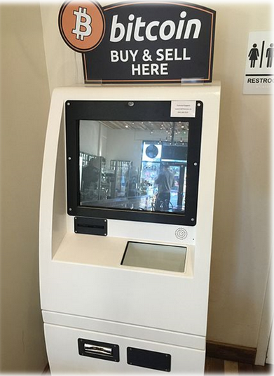
The “Blockchain” is the technology supporting Bitcoin, the infamous cryptocurrency known for being the first widely used and reportedly used in some criminal activities. Blockchain is also the technology underlying Ethereum, which is also a means to implement smart contracts. There is an increasing interest around Blockchain because it promises disruptive changes in banking, insurance and other sectors narrowly involved in everyday life. In this blog entry, I will try to explain what is Blockchain and how it works. In the next entry, I will present some uses in the energy sector.
Blockchain is an account book, a ledger. It contains the transaction records made between two parties, like “On April 3, John sold 3 potatoes kilos to Anthony and paid 1.05 Euro”. The way Blockchain works avoid any malicious change in the records. This feature is not granted by a supervisor, but is a consequence of the consensus reached by all peers participating in the Blockchain. This has consequences of paramount importance. For instance, when Blockchain is used to implement a payment system, like Bitcoin, it is not needed a bank supervising and facilitating the transaction anymore. Even it would not be necessary to have a currency as we currently have.
The blockchain is a decentralised application running on a peer-to-peer protocol, like the well-known BitTorrent, which implies all the nodes in the Blockchain have connections among them. The ledger is stored in all the nodes, so every node stores a complete copy of it. The last component is a decentralised verification mechanism.
The verification mechanism is the most important part because it is in charge of assuring the integrity of the ledger. It is based on consensus among nodes and there are several ways to implement it. The most popular ones are the proof-of-work and the proof-of-stake.
The proof-of-work is the most common verification mechanism. It is based on solving a problem that requires certain amount of computing effort. In a nutshell, the problem is to find out a code called hash using the block content (a block is a set of recent ledger inputs). The hash is unique for a given block, and two different blocks will always have different hashes. The majority of the nodes must agree in the hash value, and if some of them find a different hash, i.e. if there is no consensus, the transactions in the block are rejected.
Applications based on Blockchain can be classified into three different categories according to their development status. Blockchain 1.0 are the virtual cryptocurrencies like Bitcoin and Ether. Blockchain 2.0 are the smart contracts. A smart contract is a contract with the ability to execute by itself the agreements contained in it. This is done with no need for a supervisor who verifies the contract compliance. Finally, Blockchain 3.0 develops smart contract concept further to create decentralised autonomous organisational units that rely on their own laws and operate with a high degree of autonomy.
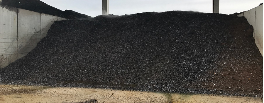
Artificial soils, also called tecnosoils, technosols or technosoil are, as the name implies, artificial soils made from mixtures of different non-hazardous waste and by-products. These technosoils are usually complemented with other raw materials for their application both in the improvement of agricultural soils and in the restoration of degraded areas.
The main applications of the tecnosoils are amendment for agricultural soils, material for the recovery of degraded and/or contaminated soils and water, covering of rubbish dumps, employment in areas affected by urban works and infrastructures (roundabouts, roadsides and areas non-recreational garden areas), material for the recovery of mines and quarries or soils degraded by erosion, fire or loss of productive capacity.
The elaboration of the mixtures in order to obtain these artificial soils has a double purpose; on one hand, waste are valorized, minimizing the potential environmental impacts derived from a poor management of these and, on the other hand, degraded soils are recovered without excessive costs.
The idea is to take advantage of all the available resources in the market to valorize and transform them into the best amendments, fertilizers and tecnosoils, essential for the optimal management of agricultural soils or for the correct restoration of soil and environmentally degraded spaces. In this way, wealth is also generated and it is managed to avoid the unwanted and unnecessary elimination of multiple residues and products currently underutilized, able to be reincorporated to a new life cycle, maintaining an environmentally and economically sustainable model that also favors the fight against climate change.
We are working on projects developing tecnosoils inCARTIF, one of them is SUSTRATEC Project, which aims to develop precisely innovative tecnosoils, i.e., artificial soils, which will also possess special features that will make them innovative.
The main novelty of these technological substrates is that they will have a self-fertilizing capacity as well as atmospheric pollutant uptake. The aim is to create “soils to the letter“ and to amend agricultural soils taking into account the different problems. The tecnosoils to be developed will come from the valorization of the sludge coming from the purification plants and agri-food industries. These soils will be complemented with other raw materials such as sugar foams, mussel shell, coffee residues, or pruning, in addition to other additives.
One of the main innovative elements will also be the inclusion of encapsulated bacteria in tecnosoils that will be developed, and that they exert beneficial effects in the field, improving the fertility due to its capacity to fix nitrogen. In addition, artificial soils fixes atmospheric pollutants and contribute to reduce greenhouse gas emissions into the atmosphere.
One of the most important challenges that our society must face is how to transform our cities into more accessible, sustainable and efficient places. Our cities are, at this moment, in the very initial stages of this transformation, trying to get adapted to the new social challenges of the 21st century. To reach this ambitious objective, our cities have several plans for urban transformation, whose objectives while very interesting and ambitious, are far from being totally accepted by citizens as these lack of an essential aspect: integration. So we still have a long path in front of us.
The most important premise in this transformation process is that a city belongs to its citizens. It is essential to reinforce this motto, so that the citizens are at the center of this transformation process. Thus, as a direct consequence, any action to be deployed in a city must answer to its own identified challenges, following a city-led approach. And these, in turn, must have been identified considering their citizens’ concerns in a participatory process.
It must be added that in this process there are very good news. In order to implement this necessary transformation, we do not start from scratch. In almost any medium- or big-sized European city we can find medium- or long-term plans in the main sectors that regulate our lives in community. These plans are related to the built environment such as urban planning; the energy sector, with the energy plans, renewable energy deployment plans or the environmental sector in which many European cities have their own Sustainable Energy Action Plans to reduce emissions and their strategies to adapt to climate change with their Adaptation Plans. With respect to fostering efficient and sustainable mobility, we can find Sustainable Urban Mobility Plans. Finally, regarding economy and digitalization, we can find the Digital Agendas or Local Economic Development plans respectively.
On the contrary, the bad news are that all these plans are deployed in an isolated way, promoting very ambitious individual actions that pursue a high impact but lack of an integrated approach. Thus, the final impact is not as good as initially expected. The main remaining challenge is then to identify or establish interlinks and synergies among all these plans and this can only be achieved through a clear and well-structured analysis of the direct and indirect effects that each decision made will produce in the city and their citizens. Moreover, this integration would allow to prioritize all this actions set out in the existing plans following a holistic approach. The result of all this process would be a so-called integrated urban plan.
One of the most attractive aspects of the future cities is their transformation into economic engines, developing stable local economic ecosystems for investors and business. Ideally, this ecosystem will depend in a lesser extent on the exterior policies and will be based mainly on a sustainable local economy concept, always led by the city’s needs and strengthened with new digital services developed in a space of co-creation and co-design. Thus, again citizens are at the core of this process. As a consequence, strengthening this economic ecosystem and the industrial fabric of the city will increase its attractiveness, leading to the establishment of local talent and the development of new enterprises, especially under emerging business models; like entrepreneurship, start-ups and SMEs. This is the city business model.
The new generations of Lighthouse Smart City Projects, like our brand new mySMARTLife project, promote this new integrated vision towards a new city model. The concept of Innovative Urban Transformation promoted in mySMARTLife is based on the generation of comprehensive urban plans, which will allow a more efficient cityplanning, promoting the development of an urban transformation strategy based on strengthening the citizens’ engagement, developing a local economy ecosystem for the creation and maintenance of employment around the new city services that will result from the deployment of the integrated urban plan of the city.
The cities of Nantes (France), Hamburg (Germany), Helsinki (Finland), Varna (Bulgaria), Bydgoszcz (Poland), Rijeka (Croatia) and Palencia (Spain) have accepted to be part of this challenge.
But they are not alone. Dozens of cities throughout Europe and the rest of the world are already immersed in smart city projects, benefiting from the joint effort of researchers, companies and municipalities in finding solutions to their own challenges as cities.
In CARTIF, we are currently working with more than 100 European cities through our smart city projects. An exciting challenge. Would you like to be part of this transformation?
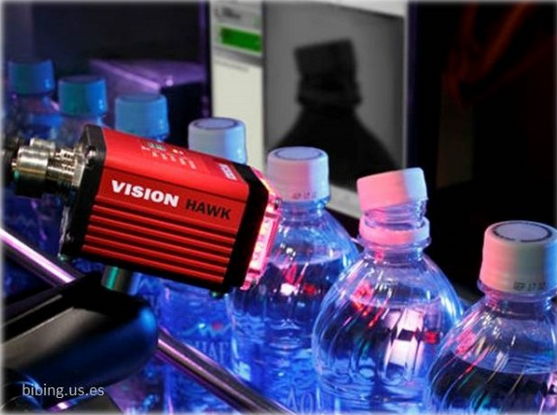
Machine vision is behind many of the great advances in the automation of the industry since it allows the control of quality of 100% of the production in processes with high cadences.
A non-automated process can be inspected by the operators themselves in the production process. However, in a highly automated process, inspecting the total production manually is a really costly process. Sampling inspection, i.e. determining the quality of a lot by analyzing a small portion of the production, has been used as a compromise solution, but due to the increasingly demanding quality demands of the final product, sampling inspection is not the solution.
It is in this context that the need to incorporate automatic systems for quality control arises, among which stands out the visual inspection through machine vision. The human ability to interpret images is very high, adapting easily to new situations. However, repetitive and monotonous tasks cause fatigue and therefore the performance and reliability of the operator’s inspection decline rapidly. One must also consider the inherent human subjectivity that makes two different people provide different results in the same situation. It is precisely these problems that can best address a machine, because it never tires, is fast and results are constant over time.
It is logical to think that the aim of a machine vision system is to emulate the virtues of people’s vision. For this, the first thing we must ask ourselves is, “what do we see with?” A simple question that common mortals would answer without hesitation “with the eyes”. However, the people who dedicate ourselves to machine vision would answer in a quite different way and say “with the brain”. Similarly, it can be thought that cameras are in charge of “seeing” in a machine vision system, when really that process is carried out by the image processing algorithms.
Obviously, in both cases it is a simplification of the problem, since the process of vision, natural or artificial, cannot be carried out without involving both eyes / cameras and brain / processing, without forgetting another key factor, illumination.
Many efforts have been made to try to emulate the human capacity to process images. This is why in the 1950s the term Artificial Intelligence (AI) was used to refer to the ability of a machine to display human intelligence. Among those capacities is that of interpreting images. Unfortunately, our knowledge about the functioning of the brain is still very limited, so the possibility of imitating such functioning is too. The development of this idea in the field of machine vision has been carried out by means of what is called Machine Learning (ML) popularized in recent years with the techniques of Deep Learning (DL) applied to the understanding of scenes. However, these techniques do not really have intelligence behind them, but rather are based on feeding them with a huge amount of images previously labeled by people. The processing that allows to classify the images as expected is considered like a black box and really, in most cases, we do not know why it works or not.
When machine vision is applied to the industry for the quality control there is usually not enough data to apply these techniques and it is required that the behavior of the system is always very predictable, so these techniques have not yet been popularized in the industry. That is why, when developing applications of machine vision for the industry, the objective is to solve well-defined problems in which cameras and lighting are selected to enhance the characteristics that are desired to be inspected in the image and subsequently endowed the system with the capacity of interpreting the acquired images with really low error levels.
Finally, the inspection results are stored and used in the production process, both to discard the units that do not meet the quality requirements before adding them a new value or to improve the manufacturing process and therefore reduce the production of defective units. This information is also used to ensure that the product met the quality conditions when it was delivered to the customer.
Among the different applications in which these techniques can be use are geometric inspection, surface finish inspection, the detection of imperfections in manufacturing, product classification, packaging control, color and texture analysis… and so on.
At CARTIF we have carried out numerous installations of machine vision systems such as cracking and pore detection in large steel stamped pieces for bodyworks, detecting the presence, type and correct placement of car seat parts, the detection and classification of surface defects in rolled steel, inspection of brake disks, detection of the position of elements for their depalletising, quality control of plastic parts or the inspection of the heat sealing of food packaging.
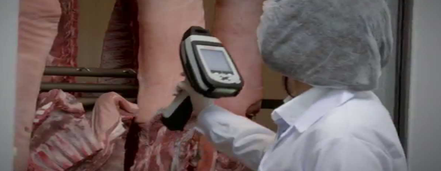
The quality control of the products we consume daily is carried out by means of reference methods that present great limitations as to the necessity of sampling (which may or may not be representative of the whole), which also entails the manipulation and even destruction of the sample (which is a significant economic expense) and does not offer us an immediate response, which makes difficult taking decisions.
The agro-food industry continuously seeks solutions of quick, simple and direct application in order to improve quality and security controls of food, both in the final product and in the different phases of its production chain, starting with the variability in raw materials.
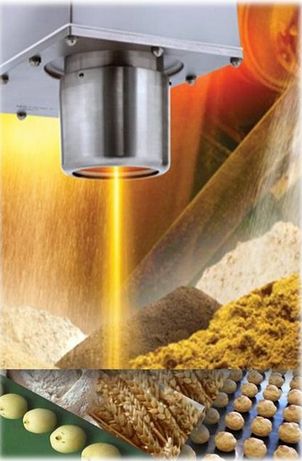
The spectroscopic (near-infrared) NIR technique alone or combined with hyperspectral imaging methods and using chemometric tools in both cases is a technology that saves the tedious, costly and long laboratory tests that the product usually requires to control its production.
NIR technology in online mode allows the monitoring of a process and product without interfering in it, to carry out a continuous and individual control of the production and continuously supervising the quality of the product, which facilitates an immediate adjustment if it would be necessary, contributing directly to the profitability of the plant.
It is true that this technique requires prior preparation of equipment with a significant associated cost, but in the medium term, it is compensated by the ease and the speed in the response to this need.
There are a lot of applications in which agro-food industry has applied online NIR in its labs, for last 15 years, but very few have implemented it directly on the production line, where its advantages are clearly evident.
What would it bring us?
With the information obtained from each product in real time and on the processing line itself, we would facilitate the taking of decision to ensure its quality and safety.
Where do we start?
Identifying the moment in which the product requires the control of some critical parameter that ensure its quality.
How do we do it?
Creating calibrations for each parameter at each point in the process that we want to control.
In CARTIF, we are sure of these advantages because we have been working with this technology for more than 15 years. We have used it frequently to support companies in the agro-food sector, starting with a diagnosis of the process to identify in what way, how and when it is most advantageous and necessary its application and developing the methodology to implement it in the company.
During these years, we have developed a wide variety of applications for very different products: from cereals to pulses, feed, eggs, dairy products, meats, cured meat products, etc., saving important challenges in terms of heterogeneity of products and the determination of minority compounds.
Currently, in CARTIF, we carry on working to companies make the most of this technology and we go on developing new interesting applications for industry and, definitively, for the consumer, such as the identification of contamination of food with potentially dangerous products for sensitive people, whether due to allergies or intolerances.
The SMART term has become part of our life. Thus, if we introduce it in Google about 1.8 million entries appear, which gives us an idea of how widespread it is. Now, not only phones are smart, we also find this term applied to watches, televisions, homes, cars or cities.
It is an emerging concept and its meaning is subject to constant revision. For example, for new products that are released to the market, the word Smart is related to advanced technologies. So it is now possible to answer calls or check whatsapp in a smartwatch. However, in more global areas such as cities, the term “Smart City” is closely linked to sustainability. As Miguel Ángel García Fuentes comments in his recent blog, a smart city is sustainable and efficient in its ecosystem. CARTIF is promoting these processes of urban regeneration in 16 cities, through our R2CITIES, CITyFiED, REMOURBAN and mySMARTLife projects, which include interventions in the fields of energy, mobility or Information and Communication Technologies.
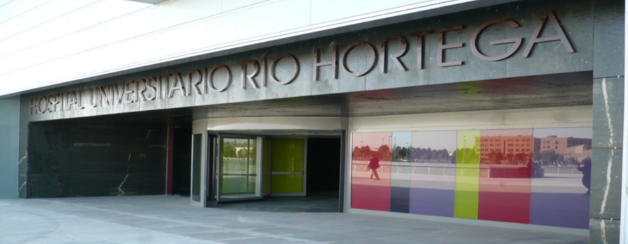
Hospitals are like small towns. As an example, a medium-sized health center such as the Hospital Universitario Río Hortega in Valladolid receives more than 250,000 consultations per year or 25,000 admissions. Hospitals are also large consumers of natural resources (water and energy) and large generators of waste. As illustrative data, a medium-sized hospital consumes per year as much electricity as the city of Soria, generates around 9.000 tons of CO2, the equivalent of 7.000 cars and if we talk about waste, the figures increase to 3 million kg per year. In this way, the health sector contributes significantly to climate change (another term we are increasingly familiar with).
During the last 2 years, CARTIF has been deploying this Smart concept in the healthcare sector through the SMART Hospital project, funded by the European Commission’s LIFE call. The document “Healthy Hospitals Healthy Planet Healthy People. Addressing climate change in health care settings” identifies the 7 key elements of a sustainable hospital: energy efficiency, green building design, alternative energy generation, transportation, food, waste and water. Among these elements, LIFE Smart Hospital project has selected Energy Efficiency, Water and Waste. Thus, the demonstrative experience that is being carried out at the Hospital Universitario Río Hortega includes the application of best practices and available technologies and customized training in each of these three axes.
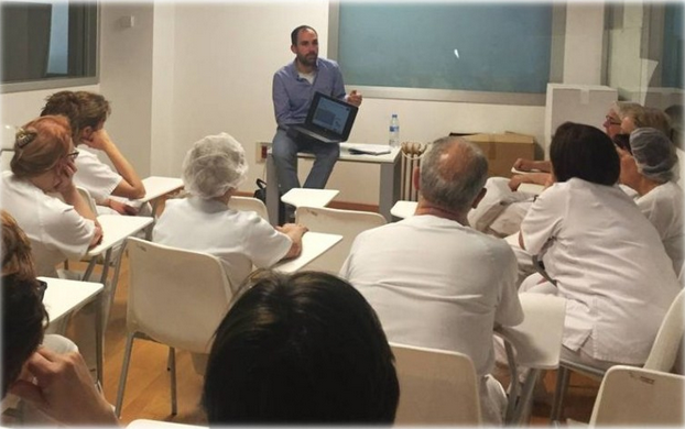
In the energy axis the actions that we have already implemented include the optimization of boilers, air conditioning and ventilation of the operating rooms, or improvements in lighting. In the water axis, we have identified the streams that were being discharged to the public sewage system without being sufficiently contaminated and different measures for their reuse were proposed. In this way, reject from the water plant of the hemodialysis unit has been taken to hospital cisterns. In addition, the outlet water from the evaporative panels has been recirculated to the toilet flushing network. Just as in the two previous axes, the concept “Smart” has meant optimizing engines, valves or pumps, in the case of waste, the concept involves people. Thus, training has been given to the 2,500 hospital workers for the proper classification, segregation and collection of waste.
Throughout the current year, we will quantify the effectiveness of measures implemented, not only in terms of saved kWh, liters of water, kg of waste or euros, but also in the form of environmental indicators such as carbon footprint or water footprint. In addition, we will publish a “Manual on sustainability in hospitals” that includes all these actions and favors the replication of the Smart Hospital project to other hospitals, at national and international level.
It is a very promising initiative and is attracting a great interest among the different stakeholders involved. Thus in October 2015, the project received the second prize of the OMARS awards, as the second best action in environmental sustainability in Spanish hospitals.
From CARTIF we encourage other hospitals and large areas (airports, supermarkets, shopping centers, thematic parks, etc.) to apply this “Smart” concept, making a smart use of its resources and thus achieve technical, economic and environmental improvements for a more sustainable future.